Project S1 · Survey & site topography
Topographic survey to base plan
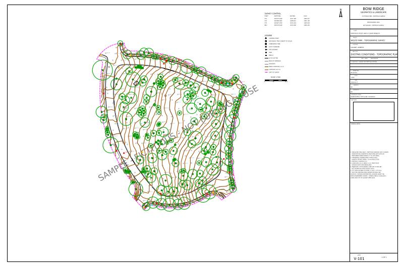
Wolfe Park, Calgary (2.35 ha). 1,341 total-station and RTK shots were checked, corrected with an audit trail, turned into linework and a breakline TIN, and issued as a 1:500 topographic plan (DWG / PDF).
Simulated field data. Observations were generated from NRCan LiDAR and City of Calgary open data with an
instrument error model, and 24 realistic field mistakes were deliberately seeded so the office QA could be measured.
Results
24/24
Seeded field errors caught
22/24 using the field file alone; 5 false alarms
24/24
Resolved in review
0 wrong fixes; 2 good shots dropped as a side effect
3.9 mm
Linework vs true edges
mean vertex offset, max 47 mm; 0 linework issues
5.6 cm
Surface RMSE vs LiDAR
near curbs 4.5 cm with breaklines, 5.4 cm without
From field shots to drawing
Drag the slider: raw coded shots on the left, the finished plan on the right (same extent).
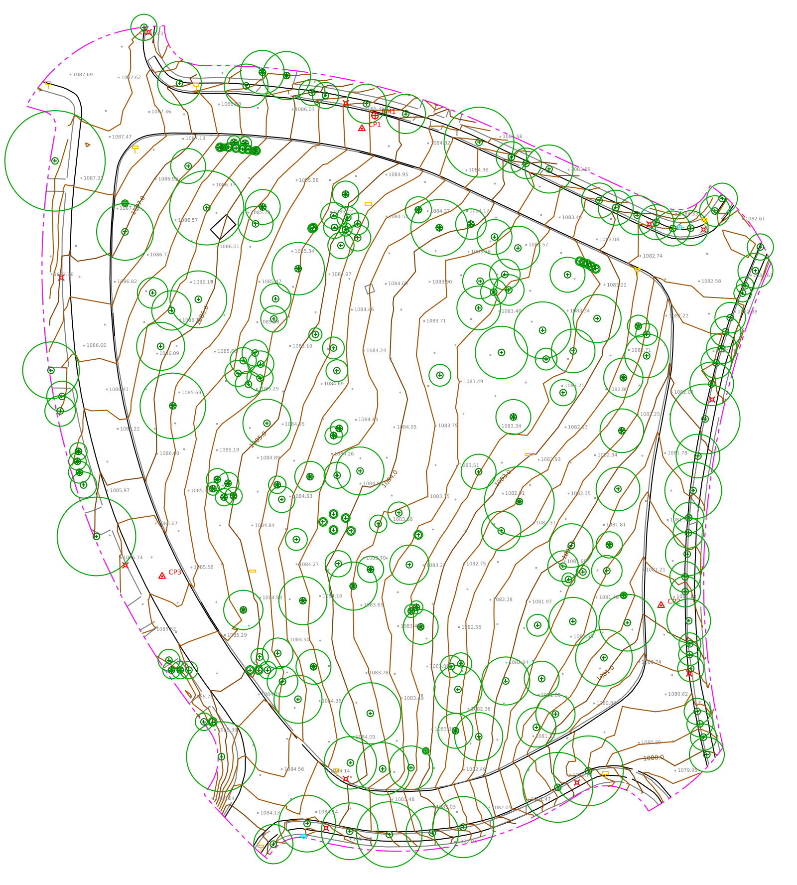
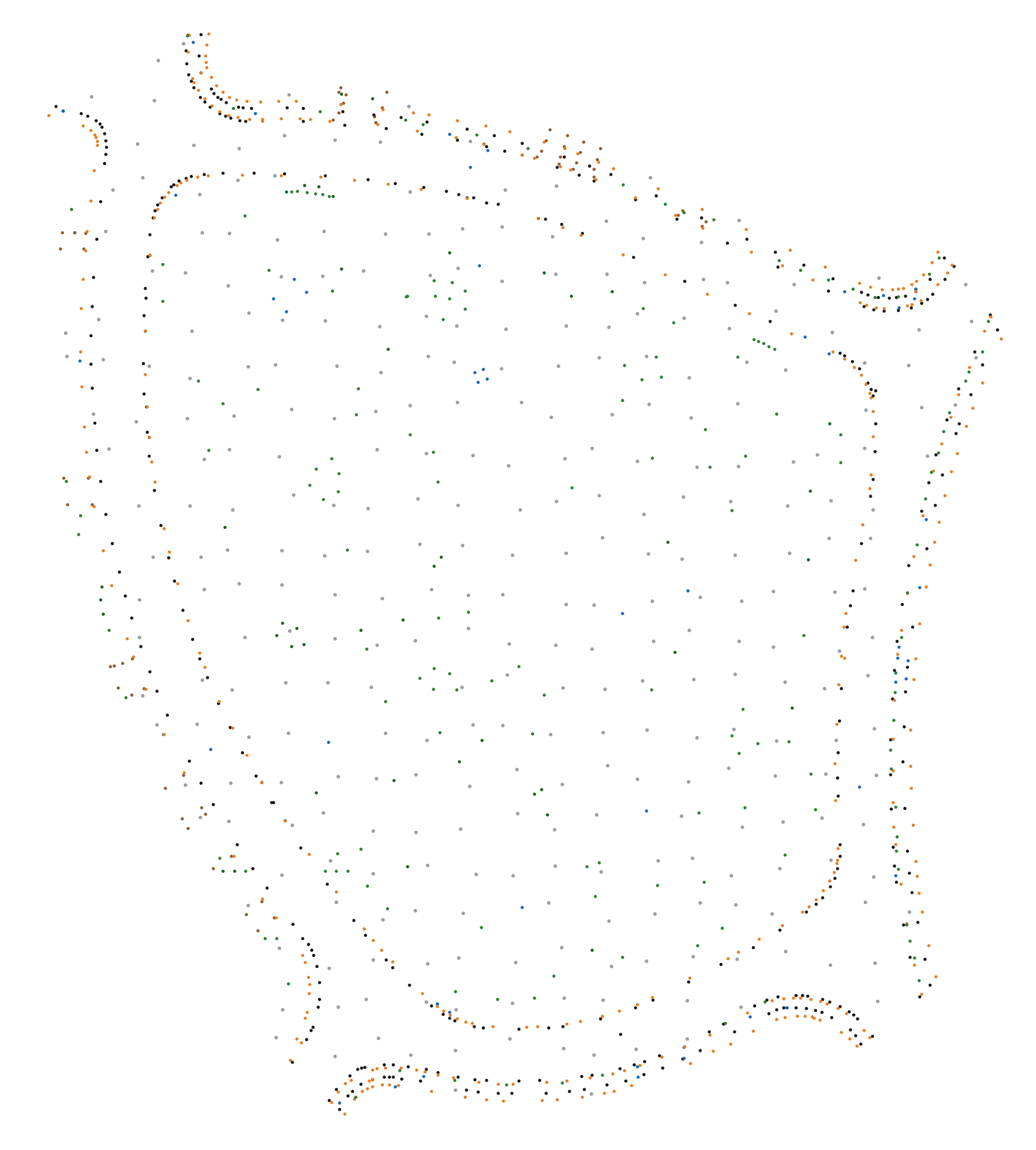
Field shotsTopographic plan
Interactive QA map
Rings mark the 33 shots flagged on the first QA pass: red = a seeded field error that was caught, orange = no seeded error (a false alarm, or a knock-on effect of a nearby error). Click a ring to see what was found and what the reviewer did.
No third-party basemap: every layer on this map comes from the project.
Workflow
Field file
PNEZD with firm-neutral feature codes and line control (B / E / CLS).1014 TS + 323 RTK shots
Automated QA
Codes and attributes, string logic, duplicate numbers, slope-aware elevation checks, spikes and line reversals, LiDAR comparison.Python · field-code library · PDAL
Review with audit trail
Rule-based corrections, every change logged; shots with vertical blunders kept out of the surface.corrections log (CSV)
Linework
Field-to-finish figures by code and string; second QA on the geometry (crossing breaklines, one-point strings).86 figures
TIN & contours
Constrained Delaunay with breaklines; 0.25 m contours, 1 m index.Triangle · 2114 triangles
Drawing
Firm CAD standard layers, symbols and title block; ARCH D at 1:500; DWG, DXF, PDF.ezdxf · ODA File Converter
What this shows
| Skill | Where it shows up in S1 |
|---|---|
| Processing field data | Coded shots turned into linework and a surface without manual redrawing. |
| Catching field errors before they reach a drawing | 24 of 24 seeded mistakes flagged; every correction traceable to a QA finding. |
| Canadian coordinate systems | NAD83(CSRS)v7 epoch 2010, Alberta 3TM 114°W, CGVD2013; a 1.25 m offset in city open data found and calibrated. |
| Drafting to a firm standard | Layer standard, symbol library, title block and sheet layout; DWG compatible with AutoCAD. |
| Surfaces and contours | Breakline TIN checked against independent LiDAR. |
| Working efficiently and verifying automation | Scripted, repeatable pipeline; the checks were themselves scored and tuned (first version raised 96 false alarms). |
Seeded errors by type
| Error type | Seeded | Caught |
|---|---|---|
| attribute error | 3 | 3 |
| code typo | 6 | 6 |
| duplicate point number | 3 | 3 |
| elevation blunder | 4 | 4 |
| horizontal blunder | 2 | 2 |
| missing begin | 2 | 2 |
| missing end | 2 | 2 |
| wrong valid code | 2 | 2 |
Coordinate system & data
- Horizontal: NAD83(CSRS)v7, epoch 2010, Alberta 3TM reference meridian 114° W (EPSG:22763). Vertical: CGVD2013.
- Terrain: NRCan CanElevation LiDAR, Calgary 2020 (43 pts/m²), Open Government Licence – Canada.
- Features: City of Calgary Open Data (curb-gutter-sidewalk, trees, lights, hydrants, signs), aligned to the LiDAR with a measured +1.00 m E / −0.75 m N correction.
Limitations
- Field observations are simulated; this shows office processing, not Canadian field experience.
- Manholes, catch basins, top of curb and gutter flow line are not shown (no open data).
- LiDAR-based checks are optimistic because the simulated terrain came from the same LiDAR; the field-only result is reported separately.
- Contours are unsmoothed TIN contours; a Civil 3D version of the same data is planned for comparison.